Lower Athabasca Regional Plan Map
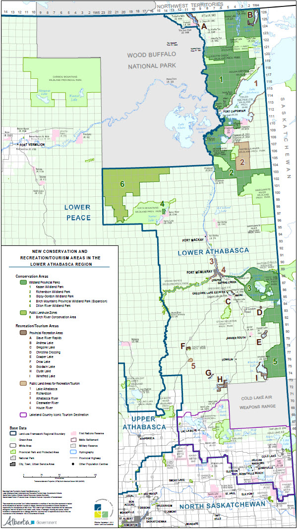
 Lower Athabasca Regional Plan (2012) which took effect on September 1, 2012, sets the stage for the next 50 years, concentrating on environmental, economic and social actions. This includes establishing six new conservation areas, moving Dillon River Conservation Area from a Public Land-use Zone to a Wildland Provincial Park, and creating nine new provincial recreational areas as identified in the
Lower Athabasca Regional Plan 2012-2022 Schedule G Map (2012) below.
Lower Athabasca Regional Plan (2012) which took effect on September 1, 2012, sets the stage for the next 50 years, concentrating on environmental, economic and social actions. This includes establishing six new conservation areas, moving Dillon River Conservation Area from a Public Land-use Zone to a Wildland Provincial Park, and creating nine new provincial recreational areas as identified in the
Lower Athabasca Regional Plan 2012-2022 Schedule G Map (2012) below.
To view and download this map or any maps associated with the Lower Athabasca region including the Regional Advisory Council's advice to government, refer to
Maps and Shapefiles.