Upper Peace Region
Status: The Upper Smoky Sub-Regional Plan is approved and implementation is underway.
This common-sense plan will protect local jobs in the energy, forestry and tourism sectors while increasing wildfire protection and responsibly managing the environment.
The Upper Smoky Sub-Regional Plan uses three clear zones to guide what development is permitted:
- “Nature First” zone: 3,200 km2, including parks and protected areas, where virtually all industrial development is currently prohibited. These areas focus on conservation, habitat restoration, outdoor recreation and traditional land use.
- “Slow Go” zone: 5,113 km2 where some resource development is allowed with restrictions to manage the footprint and reduce the environmental impact. This will include a new Public Land Use Zone near Grande Cache to help support sustainable recreation and tourism opportunities.
- “Go” zone: 4,928 km2 where a full range of development opportunities, including recreation and grazing, are allowed.
Alberta Forestry and Parks will have completed a wildfire mitigation plan for the area within 60 days of implementation, protecting local communities and critical wildlife habitats from the threat of wildfire.
The plan will expand conservation efforts increasing the total area of parks and protected areas in the sub-region to nearly 3,200 square kilometres through two proposed conservation areas, almost four times the size of Calgary. It also sets Alberta’s first restoration targets for legacy seismic lines and inactive well sites in caribou habitat, backed by new reporting requirements.
Once the Upper Smoky Sub-regional Plan and regulatory details come into effect on January 1, 2026, Alberta will establish an implementation committee to ensure local perspectives – including Indigenous communities, municipalities and industry – continue to shape how the plan is put into action.
For more information about the Upper Smoky Sub-regional Plan, please visit the Caribou recovery planning website.
For the Government of Alberta news release and a list of related documents, click here.
The Upper Smoky Subregional Plan can be found on the King's Printer here
The regulatory details for the Upper Smoky Subregional Plan have been incorporated as Part 8 of the South Saskatchewan Regional Plan, which can be found on the King's Printer here
|
UPRP Regional Planning
Status: Not Started
Developing the Upper Peace Regional Plan (UPRP) is a phased approach that begins with gathering and assessing information, input and advice, followed by receiving feedback and drafting the regional plan, and ends with finalizing and approving the plan. Making and Amending Regional Plans offers more information about the planning process.
|
UPRP Regional Advisory Council
Status: Not Started
A Regional Advisory Council (RAC) is composed of a cross-section of individuals who live, work, recreate and/or have an interest in the region, and are able to strategically consider what is best for the entire region at a holistic level. Administration presents more information about the role of Regional Advisory Councils.
|
|
UPRP Consultation
Status: Not Started
Contributions from the Regional Advisory Council, First Nations and Métis groups, stakeholders, municipalities and the public inform the development of the regional plan. Visit Public Consultations to discover how to contribute to regional planning.
|
UPRP Regional Plan
Status: Not Started
The regional plan sets out a new approach for managing our lands and natural resources to achieve our province's long-term environmental, economic and social goals. When a regional plan is approved by Cabinet, it becomes law. Learn more about the binding effect of regional plans at Nature and Effect of Regional Plans. |
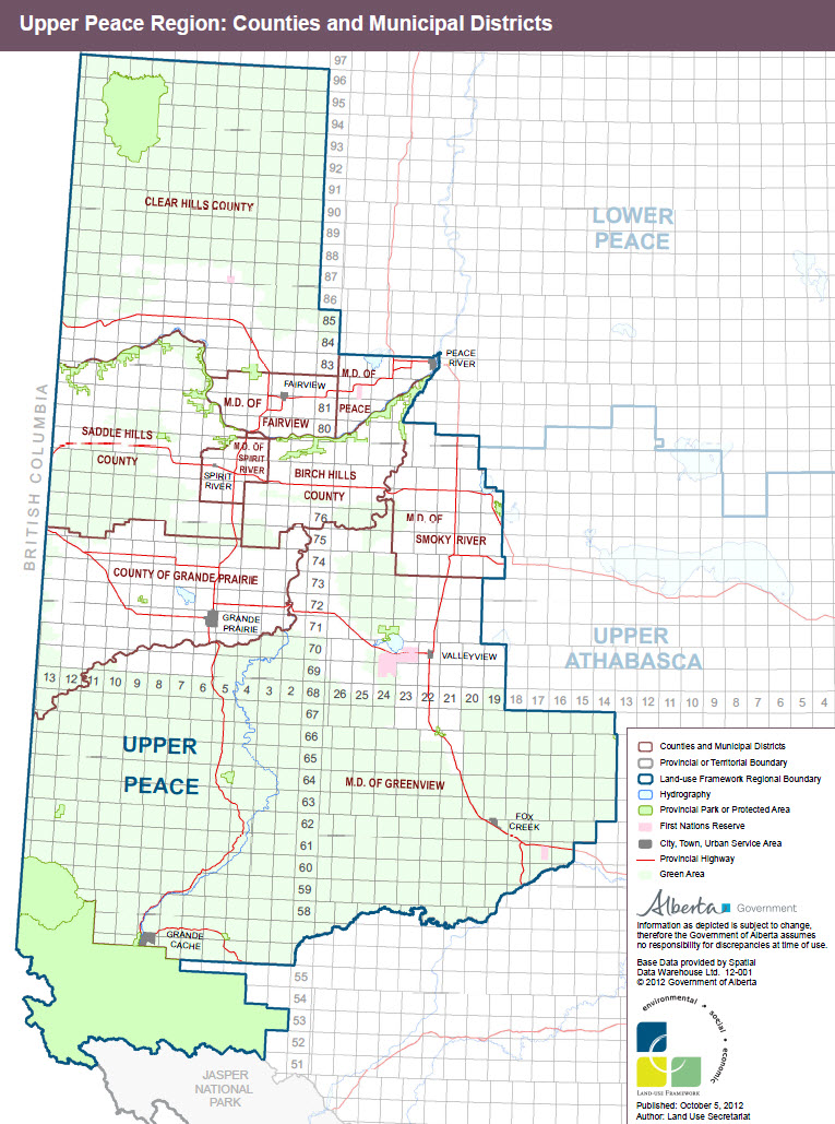
Upper Peace Planning Region
To download the regional map, go to LUF Maps and Shapefiles and select Upper Peace Region.